Trail Trail Les Omergues - t16315-MNT - Photo
 phd04
phd04

User

© OpenStreetMap contributors
Length
Length
16.8 km
Max alt
Max alt
1426 m
Uphill gradient
Uphill gradient
762 m
Km-Effort
Km-Effort  
27 km
Min alt
Min alt
796 m
Downhill gradient
Downhill gradient
762 m
Boucle
Boucle
Yes
Creation date :
2022-04-08 12:55:59.514
Updated on :
2022-04-08 12:57:07.164

(0 Reviews)

Trail
Trail
0m
Difficulty : Difficult

Scan this QR Code to open this trail in the SityTrail application

FREE GPS app for hiking

Logo SityTrail SityTrail

IGN / Geographical institutes

Download SityTrail from the App Store Download SityTrail from Google Play

Logo SityTrail SityTrail World

The world is yours!

Download SityTrail from the App Store Download SityTrail from Google Play Download SityTrail on Huawei AppGallery

About

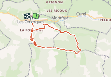
Trail Trail of 16.8 km to be discovered at Provence-Alpes-Côte d'Azur, Alpes-de-Haute-Provence, Les Omergues. This trail is proposed by phd04.

Description

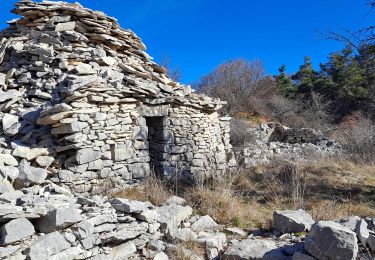
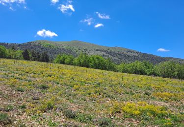
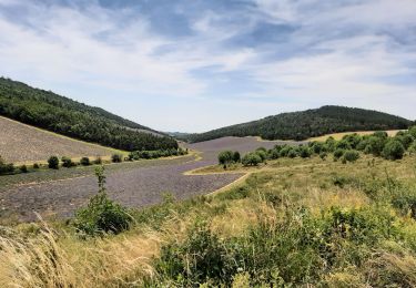
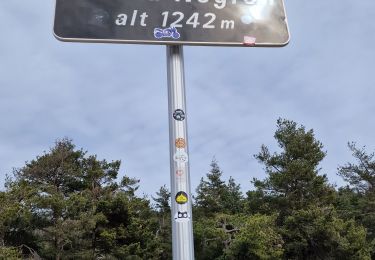
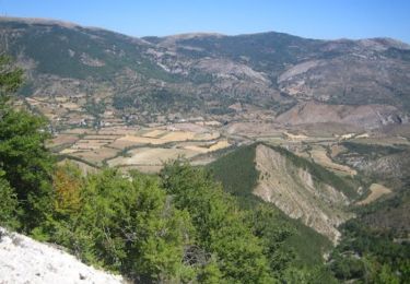
Départ des Omergues. Prendre la direction du Pas de Redortiers par le hameau "Les Fontaines". Une longue piste monte progressivement et vous amènera au sommet (1214 m). Prendre ensuite à gauche la ligne de crête pour rejoindre le Sommet de Larran (1379 m) par le GR de Pays (marquage jaune et rouge). Si vous avez le temps, faites un détour pour aller voir le Jas des Agneaux. Le GR descend jusqu'au col de la Roche (1314 m). Le suivre jusqu'au ravin de Paillar. Vous déboucherez sur une route forestière et là, prendre à gauche jusqu'au hameau de Villevieille. Suivre le PR (jaune) jusqu'au hameau des Fontaines et redescendre aux Omergues.

Elevation profile

Positioning

Country:
France
Region :
Provence-Alpes-Côte d'Azur
Department/Province :
Alpes-de-Haute-Provence
Municipality :
Les Omergues
Location:
Unknown
Start:(UTM)
708426 ; 4894119 (31T) N.

Trails nearby

Trail Walking Séderon - Du Sommet du Négron au Sommet de Larran - Photo
Walking
Marco05

Walking

Medium
Séderon, Auvergne-Rhône-Alpes, Drôme, France
15.6 km | 22 km-effort
5h 4min
No
Trail Walking Montfroc - 720505 - Photo
Walking
Marco05

Walking

Difficult
Montfroc, Auvergne-Rhône-Alpes, Drôme, France
14.6 km | 26 km-effort
5h 49min
Yes
Trail Walking Les Omergues - Saint André de villeseche. la pyramide du moine  - Photo
Walking
Roger

Walking

Medium
Les Omergues, Provence-Alpes-Côte d'Azur, Alpes-de-Haute-Provence, France
10 km | 13.6 km-effort
4h 0min
Yes
Trail Walking Barret-de-Lioure - du col du negron à la pyramide du moine  - Photo
Walking
Jemasa9

Walking

Easy
Barret-de-Lioure, Auvergne-Rhône-Alpes, Drôme, France
10.6 km | 15.1 km-effort
4h 3min
Yes
Trail Running Curel - Les Chaux - Curel  - Photo
Running
tracegps

Running

Difficult
Curel, Provence-Alpes-Côte d'Azur, Alpes-de-Haute-Provence, France
8.5 km | 16.2 km-effort
1h 21min
Yes
Trail Walking Curel - Les Chaux - Curel  - Photo
Walking
tracegps

Walking

Medium
Curel, Provence-Alpes-Côte d'Azur, Alpes-de-Haute-Provence, France
8.5 km | 16.2 km-effort
2h 30min
Yes
Trail Walking Séderon - Autour du col du Negron - Photo
Walking
PITOUSSAINT

Walking

Easy
Séderon, Auvergne-Rhône-Alpes, Drôme, France
6.6 km | 10 km-effort
3h 27min
Yes
Trail Trail Les Omergues - t16315-MNT - Photo
Trail
phd04

Trail

Very difficult
Les Omergues, Provence-Alpes-Côte d'Azur, Alpes-de-Haute-Provence, France
16.8 km | 27 km-effort
2h 30min
Yes
Trail Walking Les Omergues - les Omergues à Montfroc - Photo
Walking
PITOUSSAINT

Walking

Easy
Les Omergues, Provence-Alpes-Côte d'Azur, Alpes-de-Haute-Provence, France
84 km | 105 km-effort
6h 38min
No


Close
My subscriptions